Broadway
From the Battery to the Bronx
English book publication Harry N. Abrams, New York, 1988
Japanese edition Toto Publishing, Tokyo, Japan, 1989
Reflections
When I moved to New York from Germany in 1960, I was immediately struck by the fleeting quality of life: with little regard for the past, businesses, buildings, entire neighborhoods and their people disappeared, their memory wiped out by new buildings and inhabitants who replaced them. Over time, the impermanent nature of my chosen city and the sense of loss that came with it instilled in me the desire to document what I saw, and I moved from being a painter to becoming a photographer.
My first major, independent assignment was the Bowery, Manhattan's shortest northbound street. The infamous skid row would be my subject for nearly ten years: I photographed almost every single building on that one mile of misery, as well as the predominantly middle-aged and elderly outcasts who had made the street their home.
Just a few blocks but a world away from the Bowery, I could see, from my 20th floor perch on Fourth Avenue and 12th Street, the distinct line of Broadway that cuts through downtown, flanked by the towers of Grace Church, the Woolworth Building, and newer skyscrapers, all the way to the tip of the island. On sunny days around noon, the metallic reflections from the steady stream of cars shine through my windows like a sparkling string of pearls, and night turns the street into a river of red tail lights. On one of those bejeweled days in 1984, I suddenly said to my husband over brunch, "Why not Broadway?"
-
The jump from Manhattan’s shortest to its longest street came with countless questions. In those pre-Google Map days, it was almost impossible to even determine the exact length of the fabled avenue. Neither the Department of Transportation nor the Landmarks Commission would provide me with the information - the latter suggested I get a geological survey map and figure it out by myself. Instead, I set out to measure, step by step, the path that the Lenape Indians had originally carved into the soil of Manahatta many centuries ago: I began my project by walking the entire 21 miles - four of them beyond the Harlem River in the Bronx - to get a feeling for the street and its neighborhoods.
On my next exploration, following my intuition, I took paper and pencil with me to draw a detailed map and take notes on points of interest. Only on my third expedition did I bring my heavy Nikon F2 and additional equipment along. Since my focus was largely on architecture, I frequently used a 28 mm lens with perspective control. It took me two years to accomplish my task, and by then I knew the precise length of Broadway in my bones.
The route itself would provide the structure of the book: a stroll beginning at Number 1 Broadway at Bowling Green, the site of George Washington’s headquarters in 1776, all the way to Number 6,695, the very last house in the Bronx. Chapters were determined by the points where Broadway crossed other thoroughfares - like Fifth Avenue at 23rd Street or Seventh Avenue at Times Square.
My approach was systematic as well as subjective. New York Times contributor and author of my book, Richard Shepard, wove the multitude of images into a compelling story. Almost half a century later, on account of the ebb and flow and the relentless pursuit of gentrification of our metropolis, my personal quest can be viewed as a time capsule of the most transitory of cities.

Number 1 Broadway, former United States Lines Building
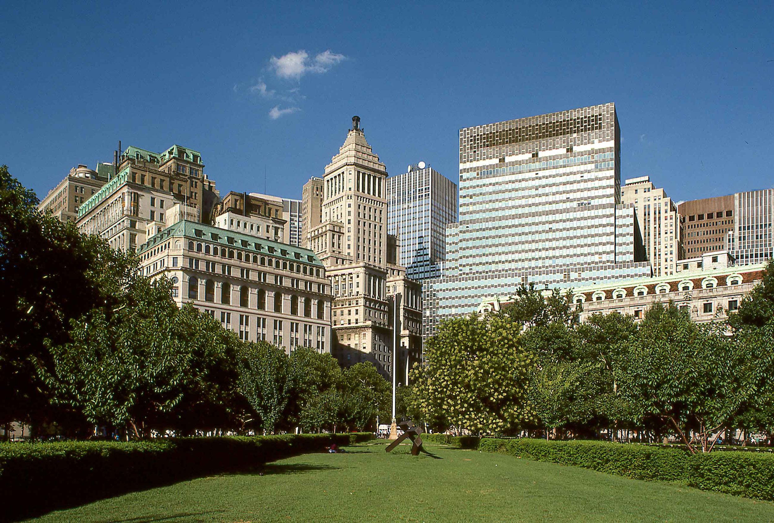
View from Battery Park toward Broadway
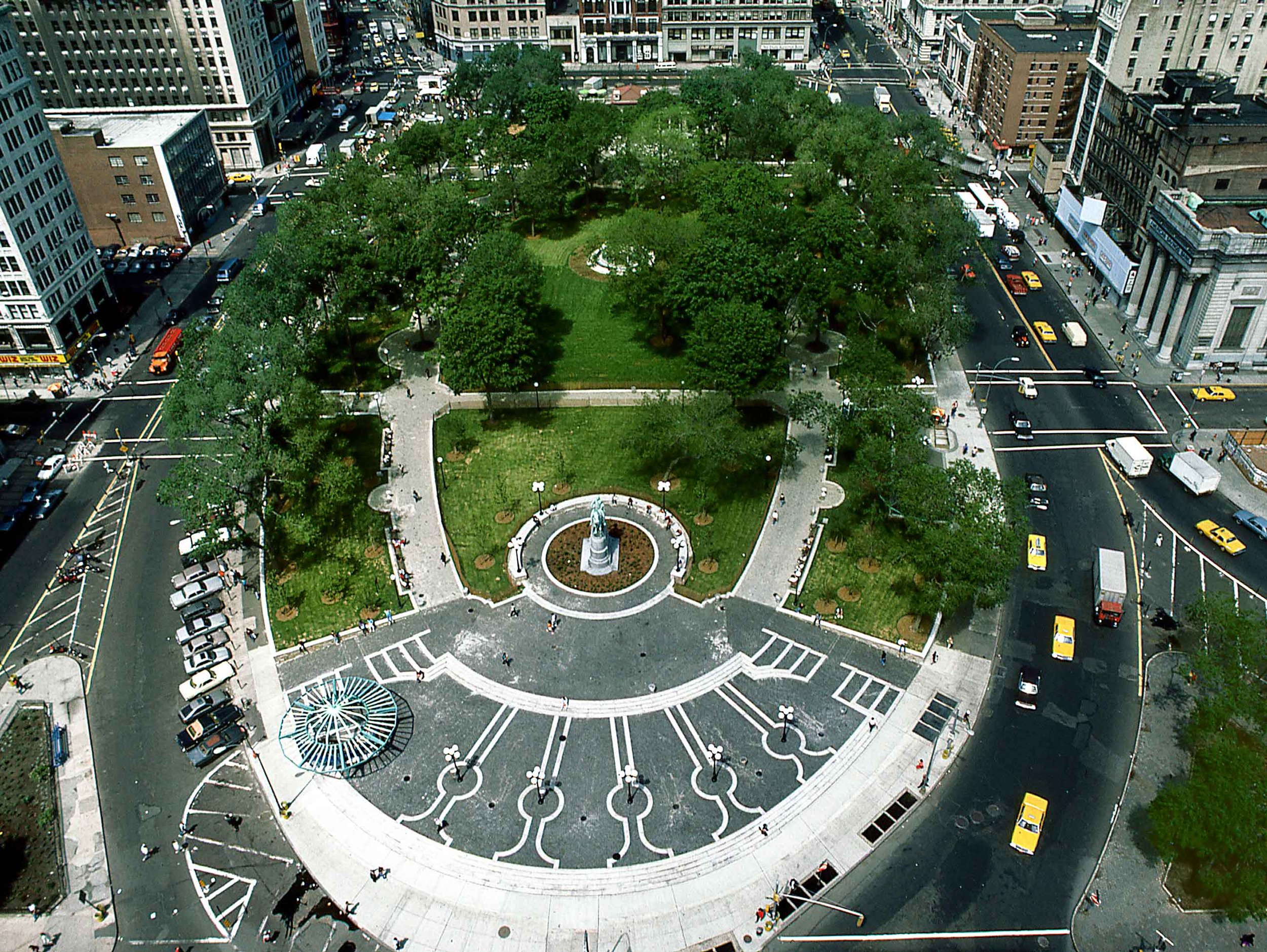
Union Square, looking north from 14th Street

Broadway crosses 6th Avenue at 33rd Street

Times Square billboard, 43rd Street

Columbus Circle, view north from NYC Department of Cultural Affairs

Broadway crosses Amsterdam Avenue

Store window, 3425 Broadway

Upper Broadway resident

Dyckman House Museum (1785), 204th Street

Branigan!s No. 6695, last building on Broadway